2004-2005
Home > Journals > 2004 – 2005: Vendée Globe
Ocean Planet Vendée Globe Update:
Monday, January 17, 2005
Position 53 29S, 78 09W, @ 14:09 UT
Screeching… to a halt!
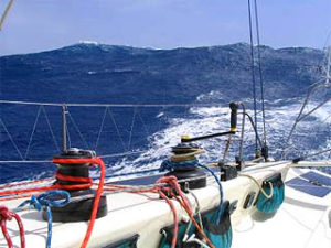
The last few days of running towards Cape Horn have been among the very best of the trip so far. There was plenty of wind, and we were able to “select” how much we wanted by careful positioning with a big weather pattern as it went by. We also had huge waves, the kind that Ocean Planet and I like that are formed by a steady breeze. These giant “tradewind” swells are great for surfing but don’t break too much.
These waves when they have time to build, I like to think of them as older, wiser, and with much less of an attitude as the waves around small intense storms. The sea has many powerful faces, and some are friendlier than others. Some of these old fellows were a good 30 feet high and quite the roller coaster ride if you can catch them.
This week’s subject on http://www.oceanplanet.org/ and www.bigelow.org/vendeeglobe, is ocean weather. Weather is a very humbling science to try to understand, but is endlessly fascinating. Have a look and see what you learn for yourself about how the winds work to form these waves.
Sadly, our fun approach to the Horn is about to screech to a near halt. No good thing lasts forever and the wind is going to conk out leaving us with several hundred miles to go. There is the possibility of having to fly the spinnaker to get around the famous corner! Conrad on Helomoto might make it around before it shuts down, even though we did indeed catch up a bit over the past few days. He is still likely to be on the other side of the “Bozo Zone” that is forming in front of me and escape. Oh well! At least at the moment it doesn’t look like a storm will jump on us before we crawl around.
Speaking of weather, many have been asking me what “grib” files are and how we look at them. Below is a shot of my Euronav SeaPro software (http://www.euronav.co.uk/) displaying a grib file over the Cape Horn area (also note the approach of Ocean Planet on the left of the screen):

You can’t see it very well in this pic, but there are little wind arrows and small text on the screen giving wind direction and velocity. You can display the data for different times, including several days into the future. Being only a NOAA computer program’s prediction, it is often wrong, but it is better than nothing! This “grib” data comes in rather small data files and is available on the internet and by email. Computers set up as grib “robot servers” automatically send the files when they get an email specifying what area and time period the data is requested. Most people use a small program to create the email request, although you can do it manually if you know how. Maxsea “Chopper” and Oceans “Weathernet” are examples of programs to get data, although for this Vendee the race directors disallowed the use of “Weathernet” for reasons that none of the English speaking skippers understood. We joked that perhaps it was because there wasn’t a version written in French….;-)
Much of today’s ocean “sailing” involves staring at these files along with weather fax or satellite pics for hours and hours on the boat’s PC. While it is true that today’s navigation itself is made easy by GPS, the tactical analysis of weather is perhaps more intense and time consuming than ever!
Ack! The wind is dying and I have to go put up more sail! Gotta run!
Bruce Schwab, Skipper
USA 05/Ocean Planet